
Can you get there from here? Online tool tracks how reach to food pantries and stores without a car — or not

Laura Oldham of Northampton rushes off the bus to get her shopping done at the Big Y store in Northampton. Oldham counts on public transportation for her shopping. She tries to fit trips to Walmart and Big Y into one hour; otherwise, she has to wait over two hours to get a bus home. “It’s nice when they have more service,” said Oldham. “Sometimes I just can’t fit the Big Y stop in.” STAFF PHOTO/CAROL LOLLIS

David Grace of Greenfield gets his bike off the bus at the Big Y stop in Northampton. “These buses are very important for grocery shopping; it’s crucial,” he said. STAFF PHOTO/CAROL LOLLIS

Laura Oldham of Northampton rushes off the bus to get her shopping done the Big Y store in Northampton. Oldham counts on public transportation to do her shopping. She doesn’t like to be away from home for long so has to fit trips to Walmart and Big Y into one hour, otherwise she has to wait over two hours to get a bus home. “It’s nice when they have more service,” said Oldham. “Sometimes I just cant fit the Big Y stop in.” STAFF PHOTO/CAROL LOLLIS
| Published: 03-24-2024 2:02 PM |
NORTHAMPTON — Food and other necessities can be found at the Goshen General Store on Route 9. For low-income individuals in Goshen and surrounding communities, the Hilltown Food Pantry, at the nearby Town Office Building, distributes food every Wednesday.
But with both places not on a fixed route for either Pioneer Valley Transit Authority or Franklin Regional Transit Authority buses, those without cars may be able to get there only by turning to the area’s micro transit options, such as the Hilltown Easy Ride van service, available to those 60 and over and veterans in Chesterfield, Cummington, Goshen, Plainfield and Worthington, or the NuRide ridesharing program overseen by FRTA.
To better understand the transportation challenges in parts of the region and provide more information to people about the options available for getting around, the Food Bank of Western Massachusetts recently unveiled the Ride WMA online mapping tool, developed by the Pioneer Valley Planning Commission.
The tool’s maps show the food, medical care, workplaces and educational centers throughout the state’s four westernmost counties, along with the transportation options. Along with aiding residents, the aim of the tool is to illustrate inadequate services and help in advocating for additional funding for public transport in neighborhoods and communities in need across the region.
“What we hope policymakers will take away is that too many people cannot get to where they need to go, whether that’s work, school, grocery shopping or medical appointments, without a reliable car or a lengthy complicated bus route,” Laura Sylvester, public policy manager at the Food Bank of Western Massachusetts, wrote in an email.
“If we want our region to be economically healthy, if we want to combat shrinking population and young people moving to cities, we need to fund public transportation more robustly and offer innovative alternatives like micro transit that work for more rural areas.”
Sylvester said that anyone who lives in western Massachusetts understands how challenging it can be to get from one area to the next without owning a car. Ride WMA makes that difficulty clear, she said.
Northampton resident Laura Oldham, who counts on public transportation to do her shopping, can attest to the difficulty. On Wednesday morning, Oldham departed the PVTA bus that stops outside the Big Y store on North King Street and had one hour — she doesn’t like to be away from home for longer than that — to shop at both the supermarket and nearby Walmart. If she can’t do it in an hour, then she has to wait more than 2½ hours for the next bus.
Article continues after...
Yesterday's Most Read Articles
“It’s nice when they have more service,” said Oldham. “Sometimes I just can’t fit the Big Y stop in.”
The interactive map, at pvpc.org/RideWMA, is funded by Transportation for Massachusetts (T4MA), a statewide coalition focused on improving Massachusetts’ transportation systems, along with Feeding America, the national network of food banks.
Shown on the map, represented by dots in various colors, are conventional supermarkets, convenience stores and neighborhood shops, as well as prominent food pantries, such as the Northampton and Amherst survival centers and Easthampton Community Center. Smaller food pantries are also shown, such as the Pioneer Valley Worker’s Center People’s Pantry in Northampton, a food pantry at the North Leverett Baptist Church and the Faith Church Food Pantry at Faith Baptist Church in Greenfield.
For each location on the map, information is provided about the services offered, the hours of operation and, if available, available transportation options, such as the specific PVTA or FRTA routes and how to access the schedules.
The Wendell Good Neighbors Food Pantry, for example, which serves Wendell and New Salem residents, is identified on the map, along with details on how to use the FRTA’s Access Program to get there.
The map shows communities with little to no connectivity to public transit as well, along with information about whether public transport for second and third shift jobs is available. It can also answer questions such as if a person takes a bus to a doctor’s office at the end of the day, whether that bus will still be running when the appointment ends.
Beyond its usefulness as a tool for getting around without a car, Sylvester said the tool illustrates the need for increased funding for the regional transit authorities and can identify innovative solutions, such as micro transit for rural areas.
“Better transportation options will lead to better health, education and employment outcomes for our residents,” Sylvester said.
State Rep. Natalie Blais, D-Deerfield, who represents many smaller towns in the region, said the Ride WMA mapping tool will help build public awareness about transit options.
“I am especially grateful for the details included regarding the innovative micro transit program that is meeting the unique transit needs of rural communities,” Blais said. “This is one of many tools available to better understand gaps in service and dig deeper into how residents could benefit from an enhanced public transit system.”
Blais points to a study released by the MassINC Polling Group last September, in collaboration with the Regional Transit Authority Advocates Coalition, showing 79% of state residents support increasing funding for the state’s 15 regional transit authorities, with nearly as many supporting using a portion of revenues from the Fair Share Amendment for this purpose.
Food bank officials observe that affordable and reliable transportation for people facing food insecurity is a key concern because it is one of the underlying causes of hunger. A 2019 U.S. Department of Agriculture study showed that almost half of Americans with low incomes and without cars live more than half a mile from a grocery store. That means public transportation is critical as an alternative to long walks, bike rides on busy streets or expensive rideshare services.
Besides helping in obtaining new funding, revealing the gaps in public transportation may also show inefficiencies in existing operations.
“The RIDE WMA online tool provides a great first step for advocates evaluating potential transit gaps in western Massachusetts,” Jacob Dolinger, the Pioneer Valley Planning Commission’s senior planner and a GIS analyst, said in a statement.
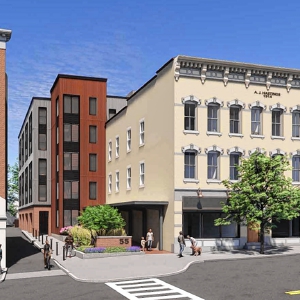 Next 5-story building cleared to rise in downtown Amherst
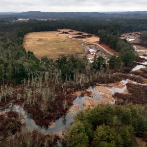 Gravel pit defenders in Granby make case
 Amherst council approves mandatory rental inspection program
 Amherst officials cool to bid to double spending hike for regional schools